The Costs We Don’t Count
Why income policy needs a systems-accounting lens
Why income policy needs a systems-accounting lens

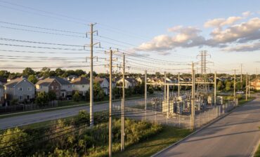
Why recovery depends on the systems that move capital, power, and goods

How AI’s physical footprint is testing its climate promise

Lebanon’s survival economy shows the limits of dollarization without recovery
What mission-driven founders need to know before converting

How three Skoll Awardees build public systems for lasting impact
Upcoming Events
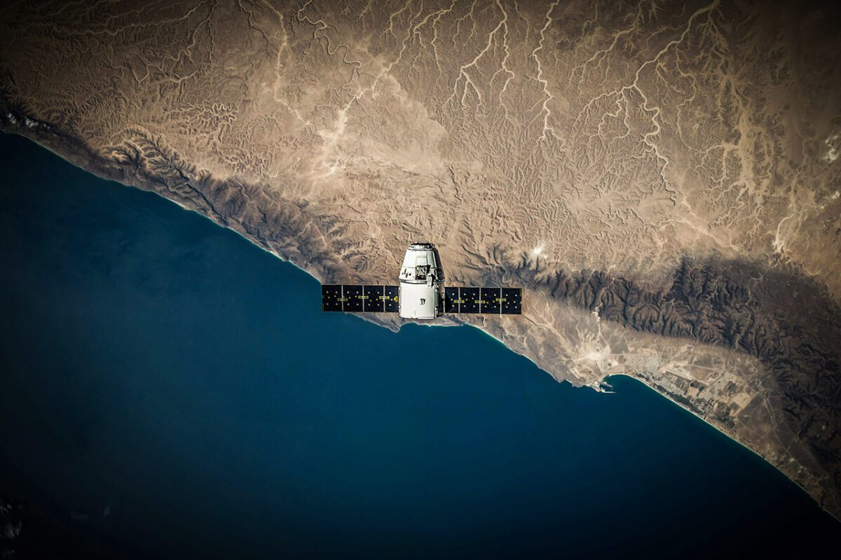
Climate change is unfolding more rapidly than ever, compelling us to innovate how we measure and understand its impacts. Satellite imagery has emerged as a reliable source of historical and current environmental data — crucial for guiding adaptation strategies and shaping responsible investments. For impact entrepreneurs and investors, these observations power informed decisions that align with the Sustainable Development Goals (SDGs) and drive meaningful social and environmental outcomes.
Since the launch of the first weather satellite in 1959, Earth observation missions have revealed profound insights into our planet’s changing climate. Early discoveries spotlighted human impacts — like ozone layer depletion — while modern technology pinpoints greenhouse gas levels, sea surface temperatures, and more. Historical datasets allow us to trace trends, such as melting Arctic ice and rising ocean levels, offering a window into how these phenomena could evolve in coming decades.
For impact-driven enterprises, these long-term views are particularly relevant. Historical data helps measure the effectiveness of sustainability initiatives, identify climate risks, and inform action on pressing challenges, from flood management to drought resilience. Essentially, satellite-based monitoring equips organizations to anticipate climate-related disruptions and design robust strategies.
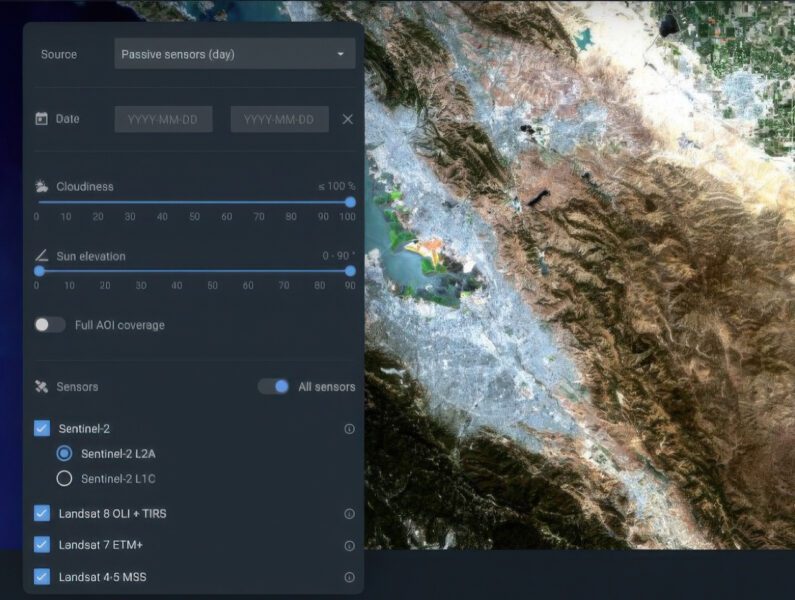 Real-Time Earth Observation; Courtesy of EOSDA Landviewer
1. Risk Assessment & Resilience Planning
Historical satellite images reveal patterns in temperature shifts, weather extremes, sea-level changes, and ecosystem stress. This information is indispensable for assessing exposure to risks like flooding, wildfires, or water scarcity:
For investors, these insights bolster due diligence by identifying climate vulnerabilities that might impact returns or corporate sustainability performance.
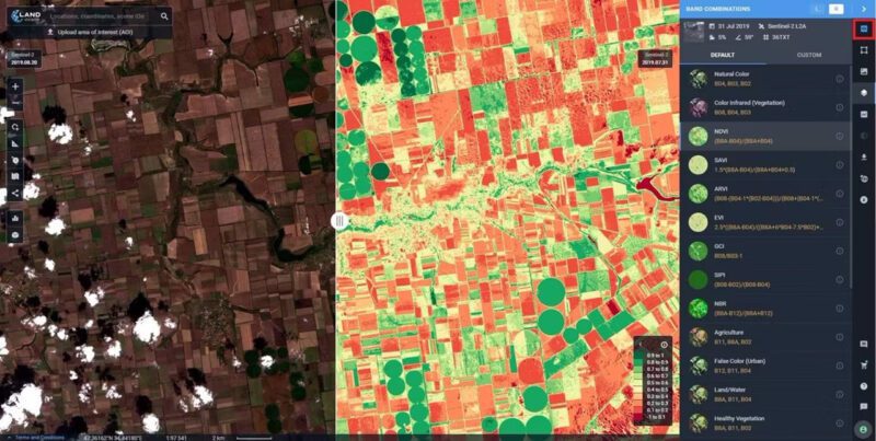 EOSDA LandViewer Interface
2. Resource management & supply chains
Satellites observe forests, oceans, and agricultural lands in near real-time. Historical imagery reveals shifts in land use, soil health, and water resources, empowering businesses to optimize resource management and minimize environmental impact. For instance:
As climate risk becomes more material to balance sheets, decision-makers increasingly rely on satellite data to shape resilient operations and direct capital toward responsible growth.
Historical data helps measure the effectiveness of sustainability initiatives, identify climate risks, and inform action on pressing challenges, from flood management to drought resilience.
3. Monitoring compliance & transparency
Governments and corporations face mounting pressure to meet environmental regulations and demonstrate ESG commitments. Detailed satellite imagery enables them to:
Organizations like the Copernicus Climate Change Service (C3S) and NOAA also supply open-access data that lends credibility to ESG reporting. This transparency not only helps entrepreneurs chart sustainable paths but also reassures investors seeking climate-aligned opportunities.


Modern remote sensing merges satellite imagery with Geographic Information Systems (GIS), creating detailed models of environmental change. Machine learning algorithms further refine this data, speeding up the detection of patterns — such as urban heat islands or glacial melting — and enabling more accurate forecasts.
Historical satellite imagery provides a powerful lens into past environmental transformations and future climate scenarios. For impact entrepreneurs and investors, this data represents an invaluable asset—enabling risk assessments, guiding resource allocation, and uncovering new opportunities for sustainable growth. As technology advances, combining decades of Earth observation with modern analytics will be a catalyst for resilient business strategies and a driving force toward systemic change under the SDGs. Now is the time to harness these insights, collaborating across sectors to meet our shared climate challenges and shape a more prosperous, equitable future for all.


Related Content
Why income policy needs a systems-accounting lens
Why recovery depends on the systems that move capital, power, and goods
How AI’s physical footprint is testing its climate promise

What Colombia’s ex-FARC cooperatives reveal about reintegration
Comments
Deep Dives

Featuring
Laurie Lane-Zucker
Founder & CEO, Impact Entrepreneur
July 30 - 12:00 PM EST
RECENT


Editor's Picks


Webinars

Featuring
Sateesh Nori
Legal Futurist
July 23 - 12:00 PM EST
News & Events

For AI governance, strategic foresight, digital economy policy, and institutional design.

Helps foundations, DAF holders, and family offices model how impact-first investing can extend charitable capital

To amplify entrepreneur voices in impact investing
Subscribe to our newsletter to receive updates about new Magazine content and upcoming webinars, deep dives, and events.
Become a Premium Member to access the full library of webinars and deep dives, exclusive membership portal, member directory, message board, and curated live chats.

Join our global community of systems-minded changemakers.
Subscribe to the Impact Entrepreneur newsletter for the latest insights, magazine features, and invitations to exclusive webinars, Deep Dives, and events.


0 Comments