The Costs We Don’t Count
Why income policy needs a systems-accounting lens
Why income policy needs a systems-accounting lens

Why recovery depends on the systems that move capital, power, and goods

How AI’s physical footprint is testing its climate promise

Lebanon’s survival economy shows the limits of dollarization without recovery
What mission-driven founders need to know before converting

How three Skoll Awardees build public systems for lasting impact
Upcoming Events
Most people don't think about the condition of the rivers, lakes, and their coastal waters unless it personally affects them. The reality is that poor water quality is far reaching and increasingly affecting everyone. A wide variety of pollutants are making their way into waterways, which don’t have the ability to recover quickly from these harmful discharges.
Poor water quality can pose significant risk to businesses. Industries such as agriculture, manufacturing, food and beverage, and tourism can all be adversely affected by contaminated water. In addition, increasing regulations, supply chain vulnerability, and reputational risk due to company impact on water resources can impact financial performance.
As climate change continues to increase the variability of the water cycle and the frequency of extreme weather events, the intensity of floods, droughts, and extreme temperatures also translate into water quality challenges. Heavy rains flush salt, oil, and brake and tire particles from roads, nutrients from agricultural production, and carry this material together with soil and sediments downstream to lakes, bays, and beaches. Droughts concentrate the pollutants and increase water temperature, reducing water quality and allowing algae to thrive, further reducing the available dissolved oxygen and biological diversity.
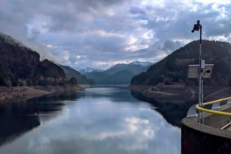
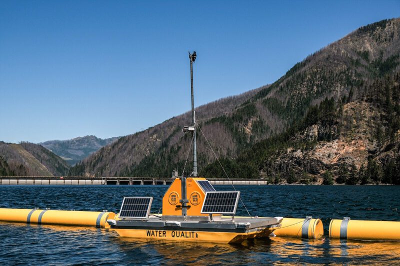 Water quality sensor on Detroit lake; Courtesy of Gybe.
An added challenge is that the impacts of pollution accumulate downstream, meaning action needs to be taken on a watershed or basin-level scale, increasing complexity by involving multiple stakeholders, such as different communities, companies, regulators, utilities, and environmental groups.
The adage of you can’t change what you don’t measure is particularly true in water quality. The first step for meaningful action is to objectively understand what the current state is in each water body.
There is a lot of data out there, but it is dispersed, incomplete and difficult to understand without context.
From satellites and advances in real time sensing and big data, companies are advancing technologies that help to monitor and detect changes in water quality. Two companies taking complementary approaches to solve this challenge are True Elements and Gybe.
There is a lot of data out there, but it is dispersed, incomplete and difficult to understand without context. True Elements is trying to solve the challenge of too much data but not enough actionable intelligence. They are bringing together existing data from close to 90 global, national, and regional sources, including fixed sensors, industry permit discharges, geographical and topographical information, crop data, soil, weather forecasts, and more. True Elements takes all this data, puts it in one place, normalizes it and visualizes it on one screen with water quality scores that are updated in real time based on new information coming in. This process makes the data understandable, provides context, and most importantly, through analysis and forecasting, provides insights decision-makers need to address short and long-term water risks.
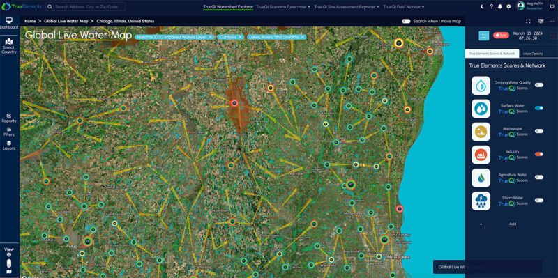 True Elements tacks multiple data sources. https://trueelements.com/.
Better data means better decisions.
It can be hard to understand what this means without examples of how it is used. A company could use it to understand water quality within their watershed to make decisions about where to site new facilities, or to evaluate operational risks for their suppliers or sites. In the US, two of the largest challenges to surface water are agricultural and stormwater runoff. By combining data such as crop data, soil, topography, and weather, True Elements can predict likely pollutant level runoff into the watershed and companies can use this to assess any disruption to operations.
There are still significant data gaps, however, as water flows through a watershed, what is in it and the impacts will vary tremendously. Sampling frequency is often a big challenge. Real-time sensors are expensive to install and maintain, and what is measured today is not necessarily representative of what is in the water body tomorrow. Traditional options for collecting water quality data are either to take a grab sample that requires a person to physically collect water and send it to a lab, or to set up lab grade sensors operating in the field requiring significant maintenance and only providing information where the sensors are installed. Having sufficient real-time data measuring a wide range of water quality parameters across large geographies is often a challenge and critical to truly understand quality and impact.
Water quality depends on the local context; as what needs to be monitored will vary based on the main challenges in a given water body. For example, in some cases, sediment transport and deposition are necessary and beneficial, carrying nutrients to floodplains, building streambanks and resilient coasts; in others, it transports excess of nutrients and can negatively impact juvenile fish or invertebrates. By understanding the local contexts, we can better understand what actions need to be taken to improve it.
Gybe is bringing a new approach to help bridge the lack of real-time data, collecting more frequent data using satellite imagery with global coverage and a new type of real-time sensor to detect changing conditions. They can monitor anything that is directly visible (for example, concentration of sediments, algal blooms or cyanobacteria, dissolved organics, and aquatic submerged and surface vegetation), as well as many things that are visible by proxy (e.g. nutrients such as nitrates, nitrites, phosphorus, dissolved oxygen, and even e coli bacteria). This opens the possibility of measuring a wide range of real-time (and historical) water quality issues in detail and across any watershed or basin.
Water quality depends on the local context; as what needs to be monitored will vary based on the main challenges in a given water body.
By taking more frequent measurements and automating data collection via existing satellites, they save organizations time and money on data collection, enabling them to focus on decision making. This approach brings the additional benefit of being able to look in the past by analyzing historical satellite imagery data, providing a baseline for understanding how the watershed has changed over time. This historical perspective allows organizations to see what changes are occurring and quantify the impact of current and past interventions, and to make the case to scale up those that are more successful.
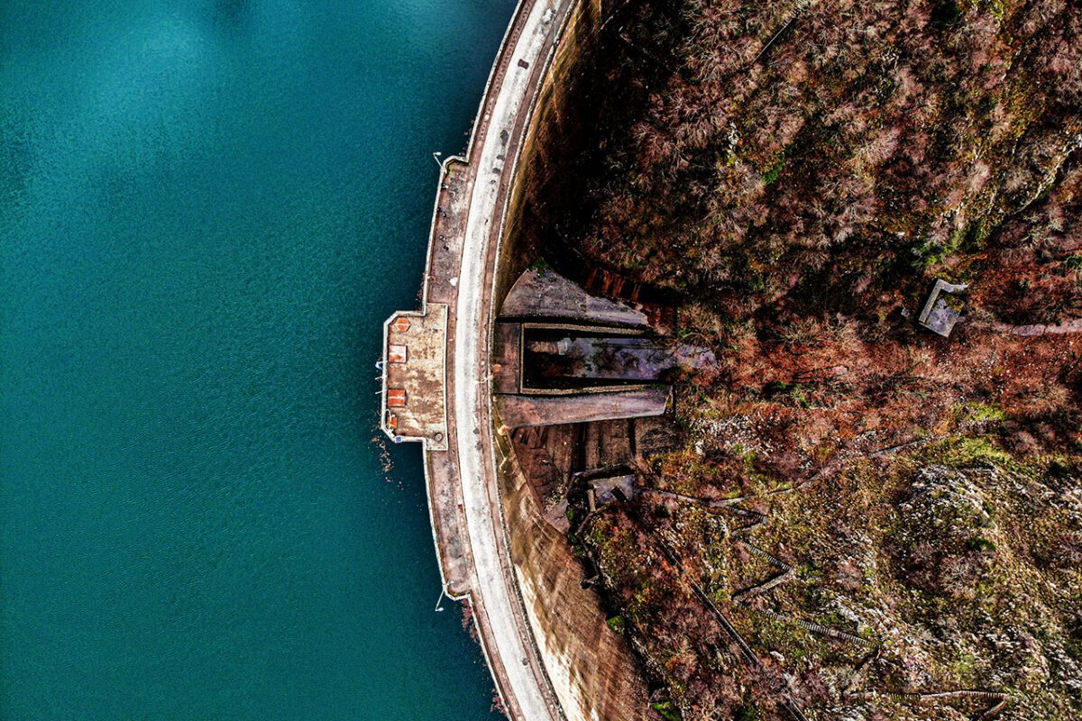
 A Detroit lake with Gybe sensor reinstalled after a fire
A company, NGO, city, or municipality, that is implementing nature-based solutions can see what activities are most beneficial and optimize for selecting, financing, and implementing solutions that are most effective to drive desired water quality outcomes. For example, Gybe and The Nature Conservancy are working together to analyze the uptake of nitrates by functioning floodplains and develop a capability to monitor nitrates across the entire Mississippi River basin to understand how implementation of different agricultural policies and practices have impacted the regional contributions of nitrates within the watershed and flowing into the Gulf of Mexico. This basin-wide monitoring will empower a basin-wide effort to reduce the nutrient flow and restore biodiversity in one of the world’s largest ‘dead zones’.
The first step to improving water quality is to understand it, and these are two companies that are working alongside their customers trying to help us to understand not only what is in our water, but what needs to be done to improve it. Data without insight is just data, and both Gybe and True Elements are providing intelligence that helps companies, NGOs, local and regional water authorities to take actions to improve the local watershed.


Related Content
Why income policy needs a systems-accounting lens
Why recovery depends on the systems that move capital, power, and goods
How AI’s physical footprint is testing its climate promise

What Colombia’s ex-FARC cooperatives reveal about reintegration
Comments

Deep Dives

Featuring
Laurie Lane-Zucker
Founder & CEO, Impact Entrepreneur
July 30 - 12:00 PM EST
RECENT


Editor's Picks


Webinars

Featuring
Sateesh Nori
Legal Futurist
July 23 - 12:00 PM EST
News & Events

For AI governance, strategic foresight, digital economy policy, and institutional design.
Helps foundations, DAF holders, and family offices model how impact-first investing can extend charitable capital

To amplify entrepreneur voices in impact investing
Subscribe to our newsletter to receive updates about new Magazine content and upcoming webinars, deep dives, and events.
Become a Premium Member to access the full library of webinars and deep dives, exclusive membership portal, member directory, message board, and curated live chats.

Join our global community of systems-minded changemakers.
Subscribe to the Impact Entrepreneur newsletter for the latest insights, magazine features, and invitations to exclusive webinars, Deep Dives, and events.


0 Comments